Category:Satellite pictures of South Africa
Jump to navigation
Jump to search
Countries of Africa: Algeria · Angola · Benin · Botswana · Burkina Faso · Burundi · Cameroon · Cape Verde · Central African Republic · Chad · Comoros · Democratic Republic of the Congo · Republic of the Congo · Djibouti · Egypt‡ · Equatorial Guinea · Eritrea · Eswatini · Ethiopia · Gabon · The Gambia · Ghana · Guinea · Guinea-Bissau · Ivory Coast · Kenya · Lesotho · Liberia · Libya · Madagascar · Malawi · Mali · Mauritania · Mauritius · Morocco · Mozambique · Namibia · Niger · Nigeria · Rwanda · São Tomé and Príncipe · Senegal · Seychelles · Sierra Leone · Somalia · South Africa · South Sudan · Sudan · Tanzania · Togo · Tunisia · Uganda · Zambia · Zimbabwe
Limited recognition: Somaliland – Other areas: Canary Islands · Ceuta · Madeira · Mayotte · Melilla · Réunion · Saint Helena, Ascension and Tristan da Cunha · Western Sahara
‡: partly located in Africa
Limited recognition: Somaliland – Other areas: Canary Islands · Ceuta · Madeira · Mayotte · Melilla · Réunion · Saint Helena, Ascension and Tristan da Cunha · Western Sahara
‡: partly located in Africa
Subcategories
This category has the following 5 subcategories, out of 5 total.
Media in category "Satellite pictures of South Africa"
The following 86 files are in this category, out of 86 total.
 Astronaut photo of Cape Town STS081-738-23.jpg 2,000 × 2,000; 5.65 MB
 Burn scars near Cape Town ESA416127.jpg 1,920 × 1,080; 741 KB
 Cape Floral Region Protected Areas map.jpg 2,730 × 1,116; 561 KB
 Cape of Good Hope Iss059e078303 lrg, Diep River.jpg 1,608 × 1,833; 796 KB
 Cape Town as seen by Envisat ESA229668.jpg 1,996 × 2,057; 1.54 MB
 Cape town Sentinel-2 L1C image on 2021-04-32.jpg 1,024 × 528; 137 KB
 Capetown table false bay.jpg 5,285 × 5,285; 6.69 MB
 Composite satellite image of South Africa ,Eswatini and Lesotho.jpg 6,533 × 5,760; 5.27 MB
 Durban, South Africa by Planet Labs.jpg 3,462 × 2,596; 3.18 MB
 Ekurhuleni, South Africa by Planet Labs.jpg 4,025 × 3,019; 5.31 MB
 Envisat captures the Orange River ESA230174.jpg 3,189 × 2,557; 1.75 MB
 Envisat captures the Orange River ESA230174.tiff 4,054 × 3,250; 24.07 MB
 Farms along Crocodile River ESA418732.jpg 3,245 × 2,318; 1.46 MB
 Gariep Dam, South Africa ESA23222985.jpeg 2,196 × 2,196; 1.28 MB
 Gariep Dam, South Africa ESA23222985.tiff 5,490 × 5,490; 86.26 MB
 ISS067-E-54068 Gqeberha, nee Port Elizabeth, South Africa.jpg 5,568 × 3,712; 2.07 MB
 Joburg.iss.400pix.jpg 540 × 405; 83 KB
 JohannesburgIntlAirport.jpg 824 × 672; 707 KB
 Kalkfontein Dam.PNG 1,408 × 933; 3.29 MB
 Karoo ecoregion.jpg 644 × 496; 114 KB
 Knysnafire 2017.png 6,838 × 4,551; 57.95 MB
 Kosi Bay satellite.jpg 768 × 1,024; 827 KB
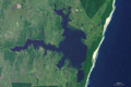 Lake Sibhayi.PNG 1,427 × 946; 3.28 MB
.jpg/120px-Phytoplankton_bloom_off_South_Africa_(6647579827).jpg) Phytoplankton bloom off South Africa (6647579827).jpg 1,200 × 1,000; 27 KB
Phytoplankton bloom off South Africa (6647579827).jpg 1,200 × 1,000; 27 KB
 Pilanesberg, South Africa ESA380982.jpg 1,920 × 1,459; 3.88 MB
 Pilanesberg, South Africa ESA380982.tiff 4,096 × 3,112; 36.51 MB
 Pongolapoort Dam sat.PNG 1,154 × 937; 2.33 MB
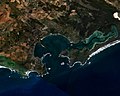 Saldanha Bay WW.jpg 1,280 × 1,024; 933 KB
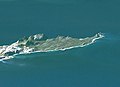
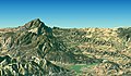
 Satellite image of Cape peninsula, Babilonstoring.jpg 475 × 411; 109 KB
 Satellite image of Cape peninsula, Cape Point.jpg 749 × 542; 89 KB
 Satellite image of Cape peninsula, Kleinriviersberge.jpg 410 × 394; 70 KB
 Satellite image of Cape peninsula, Riviersonderend, a.jpg 926 × 538; 199 KB
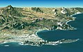 Satellite image of Cape peninsula.jpg 2,184 × 1,377; 1.46 MB
.jpg/120px-Soccer_City_Stadium%2C_Johannesburg%2C_South_Africa_(4690804881).jpg) Soccer City Stadium, Johannesburg, South Africa (4690804881).jpg 3,000 × 3,000; 4.48 MB
Soccer City Stadium, Johannesburg, South Africa (4690804881).jpg 3,000 × 3,000; 4.48 MB
 South Africa - Envisat.jpg 3,489 × 3,879; 9.71 MB
.jpg/120px-South_Africa_2017_01_18_(32030904050).jpg) South Africa 2017 01 18 (32030904050).jpg 3,584 × 2,089; 2.15 MB
South Africa 2017 01 18 (32030904050).jpg 3,584 × 2,089; 2.15 MB
.jpg/120px-South_Africa_2017_04_29_(34214934081).jpg) South Africa 2017 04 29 (34214934081).jpg 5,479 × 4,025; 3.17 MB
South Africa 2017 04 29 (34214934081).jpg 5,479 × 4,025; 3.17 MB
 South Africa ESA224732.tiff 3,489 × 3,879; 32.89 MB
 South Africa extremes.jpg 580 × 766; 245 KB
 South Africa sat.jpg 1,974 × 1,527; 1.89 MB
 South Africa sat.png 1,974 × 1,527; 4.13 MB
 South Africa-NLT Landsat7.png 1,022 × 724; 1.07 MB
.jpg/120px-Southern_Africa_2017_04_19_(33299354754).jpg) Southern Africa 2017 04 19 (33299354754).jpg 4,146 × 4,144; 4.41 MB
Southern Africa 2017 04 19 (33299354754).jpg 4,146 × 4,144; 4.41 MB
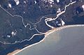 St Lucia Estuary ISS006-E-38182.jpg 3,032 × 2,006; 1.08 MB
 StLuciaWetland L7 07may01.jpg 540 × 540; 102 KB
.tif/lossy-page1-115px-STS005-40-1222_-_View_of_South_Africa_(Raw_scan).tif.jpg) STS005-40-1222 - View of South Africa (Raw scan).tif 4,393 × 4,600; 57.82 MB
STS005-40-1222 - View of South Africa (Raw scan).tif 4,393 × 4,600; 57.82 MB
 STS005-40-1222 - View of South Africa.jpg 4,393 × 4,600; 1.27 MB
.tif/lossy-page1-115px-STS005-40-1223_-_View_of_South_Africa_(Raw_scan).tif.jpg) STS005-40-1223 - View of South Africa (Raw scan).tif 4,393 × 4,600; 57.82 MB
STS005-40-1223 - View of South Africa (Raw scan).tif 4,393 × 4,600; 57.82 MB
 STS005-40-1223 - View of South Africa.jpg 4,393 × 4,600; 1.46 MB
.tif/lossy-page1-115px-STS005-40-1224_-_View_of_South_Africa_(Raw_scan).tif.jpg) STS005-40-1224 - View of South Africa (Raw scan).tif 4,393 × 4,600; 57.82 MB
STS005-40-1224 - View of South Africa (Raw scan).tif 4,393 × 4,600; 57.82 MB
 STS005-40-1224 - View of South Africa.jpg 4,393 × 4,600; 1.67 MB
.tif/lossy-page1-115px-STS005-42-1430_-_View_of_South_Africa_(Raw_scan).tif.jpg) STS005-42-1430 - View of South Africa (Raw scan).tif 4,393 × 4,600; 57.82 MB
STS005-42-1430 - View of South Africa (Raw scan).tif 4,393 × 4,600; 57.82 MB
 STS005-42-1430 - View of South Africa.jpg 4,393 × 4,600; 1.51 MB
.tif/lossy-page1-115px-STS005-44-1708_-_View_of_South_Africa_(Raw_scan).tif.jpg) STS005-44-1708 - View of South Africa (Raw scan).tif 4,393 × 4,600; 57.82 MB
STS005-44-1708 - View of South Africa (Raw scan).tif 4,393 × 4,600; 57.82 MB
 STS005-44-1708 - View of South Africa.jpg 4,393 × 4,600; 1.33 MB
.tif/lossy-page1-115px-STS005-44-1712_-_View_of_South_Africa_(Raw_scan).tif.jpg) STS005-44-1712 - View of South Africa (Raw scan).tif 4,393 × 4,600; 57.82 MB
STS005-44-1712 - View of South Africa (Raw scan).tif 4,393 × 4,600; 57.82 MB
 STS005-44-1712 - View of South Africa.jpg 4,393 × 4,600; 1.41 MB
.tif/lossy-page1-115px-STS005-44-1713_-_View_of_South_Africa_(Raw_scan).tif.jpg) STS005-44-1713 - View of South Africa (Raw scan).tif 4,393 × 4,600; 57.82 MB
STS005-44-1713 - View of South Africa (Raw scan).tif 4,393 × 4,600; 57.82 MB
 STS005-44-1713 - View of South Africa.jpg 4,393 × 4,600; 1.41 MB
.tif/lossy-page1-115px-STS005-46-1989_-_View_of_South_Africa_(Raw_scan).tif.jpg) STS005-46-1989 - View of South Africa (Raw scan).tif 4,393 × 4,600; 57.82 MB
STS005-46-1989 - View of South Africa (Raw scan).tif 4,393 × 4,600; 57.82 MB
 STS005-46-1989 - View of South Africa.jpg 4,393 × 4,600; 1.15 MB
.tif/lossy-page1-115px-STS007-19-855_-_View_of_South_Africa_(Raw_scan).tif.jpg) STS007-19-855 - View of South Africa (Raw scan).tif 4,393 × 4,600; 57.82 MB
STS007-19-855 - View of South Africa (Raw scan).tif 4,393 × 4,600; 57.82 MB
 STS007-19-855 - View of South Africa.jpg 4,393 × 4,600; 1.24 MB
.tif/lossy-page1-115px-STS007-19-856_-_View_of_South_Africa_(Raw_scan).tif.jpg) STS007-19-856 - View of South Africa (Raw scan).tif 4,393 × 4,600; 57.82 MB
STS007-19-856 - View of South Africa (Raw scan).tif 4,393 × 4,600; 57.82 MB
 STS007-19-856 - View of South Africa.jpg 4,393 × 4,600; 1.05 MB
.tif/lossy-page1-115px-STS007-20-941_-_View_of_South_Africa_(Raw_scan).tif.jpg) STS007-20-941 - View of South Africa (Raw scan).tif 4,393 × 4,600; 57.82 MB
STS007-20-941 - View of South Africa (Raw scan).tif 4,393 × 4,600; 57.82 MB
 STS007-20-941 - View of South Africa.jpg 4,393 × 4,600; 1.4 MB
.tif/lossy-page1-115px-STS007-20-942_-_View_of_South_Africa_(Raw_scan).tif.jpg) STS007-20-942 - View of South Africa (Raw scan).tif 4,393 × 4,600; 57.82 MB
STS007-20-942 - View of South Africa (Raw scan).tif 4,393 × 4,600; 57.82 MB
 STS007-20-942 - View of South Africa.jpg 4,393 × 4,600; 1.57 MB
.tif/lossy-page1-115px-STS007-20-943_-_View_of_South_Africa_(Raw_scan).tif.jpg) STS007-20-943 - View of South Africa (Raw scan).tif 4,393 × 4,600; 57.82 MB
STS007-20-943 - View of South Africa (Raw scan).tif 4,393 × 4,600; 57.82 MB
 STS007-20-943 - View of South Africa.jpg 4,393 × 4,600; 1.46 MB
.tif/lossy-page1-115px-STS007-23-1260_-_View_of_South_Africa_(Raw_scan).tif.jpg) STS007-23-1260 - View of South Africa (Raw scan).tif 4,393 × 4,600; 57.82 MB
STS007-23-1260 - View of South Africa (Raw scan).tif 4,393 × 4,600; 57.82 MB
 STS007-23-1260 - View of South Africa.jpg 4,393 × 4,600; 1.53 MB
.tif/lossy-page1-115px-STS007-23-1261_-_View_of_South_Africa_(Raw_scan).tif.jpg) STS007-23-1261 - View of South Africa (Raw scan).tif 4,393 × 4,600; 57.82 MB
STS007-23-1261 - View of South Africa (Raw scan).tif 4,393 × 4,600; 57.82 MB
 STS007-23-1261 - View of South Africa.jpg 4,393 × 4,600; 1.72 MB
.tif/lossy-page1-115px-STS007-23-1262_-_View_of_South_Africa_(Raw_scan).tif.jpg) STS007-23-1262 - View of South Africa (Raw scan).tif 4,393 × 4,600; 57.82 MB
STS007-23-1262 - View of South Africa (Raw scan).tif 4,393 × 4,600; 57.82 MB
 STS007-23-1262 - View of South Africa.jpg 4,393 × 4,600; 1.75 MB
.png/116px-STS032-71-041_-_View_of_South_Africa_(Raw_scan).png) STS032-71-041 - View of South Africa (Raw scan).png 5,700 × 5,900; 96.76 MB
STS032-71-041 - View of South Africa (Raw scan).png 5,700 × 5,900; 96.76 MB
.png/116px-STS032-71-042_-_View_of_South_Africa_(Raw_scan).png) STS032-71-042 - View of South Africa (Raw scan).png 5,700 × 5,900; 101.72 MB
STS032-71-042 - View of South Africa (Raw scan).png 5,700 × 5,900; 101.72 MB
 Table Mountain Cape Town South Africa 19Mar2018 SkySat.jpg 2,050 × 1,265; 999 KB
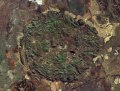
 Tankwa01.jpg 1,280 × 916; 344 KB
 Tankwa02.jpg 1,280 × 916; 345 KB
 Waterberg SPOT 1369.jpg 500 × 500; 105 KB
 Western Cape Province, South Africa ESA225097.tiff 4,546 × 4,309; 55.93 MB
 Western Cape Province, South Africa.jpg 4,546 × 4,309; 15.41 MB
 Zuid-Afrika satelliet.jpg 2,145 × 1,660; 971 KB


.jpg)


.jpg)

.jpg)
.jpg)


.jpg)


.png)
.png)


