File:South Africa - Envisat.jpg
Jump to navigation
Jump to search

Size of this preview: 539 × 599 pixels. Other resolutions: 216 × 240 pixels | 432 × 480 pixels | 691 × 768 pixels | 921 × 1,024 pixels | 1,842 × 2,048 pixels | 3,489 × 3,879 pixels.
Original file (3,489 × 3,879 pixels, file size: 9.71 MB, MIME type: image/jpeg)
Captions
Captions
Add a one-line explanation of what this file represents
Summary[edit]
| Description |
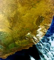
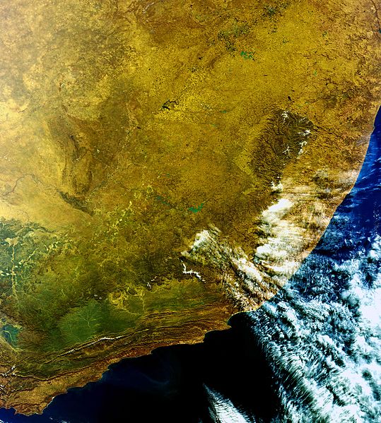
English: This Envisat image, acquired on 19 June 2010, features the vibrant colours and varied terrain of South Africa. Johannesburg – South Africa’s largest and most populous city – can be seen at the top of the image. The dark body of water located to its southeast is the country’s biggest and third largest dam by volume – the Vaal Dam. Snow is visible on Lesotho’s Drakensberg Mountains in the east. The emerald green vegetation from the Outeniqua Mountains is visible in the southwest. The city of Port Elizabeth is visible slightly west of the clouds where the coastline forms a crescent. From there, trace the coast all the way eastwards to Durban, the country’s third largest city. |
| Date | |
| Source | http://www.esa.int/spaceinimages/Images/2010/07/South_Africa |
| Author | European Space Agency |
| Permission (Reusing this file) |
ESA,CC BY-SA 3.0 IGO |
| Other versions |
|
| Title | South Africa |
| Keywords | Land use; Oceans and coastal zones; Dams and water basins |
| Set | Earth observation image of the week |
| Mission | Envisat |
| Activity | Observing the Earth |
Licensing[edit]
This file is licensed under the Creative Commons Attribution-ShareAlike 3.0 IGO license.
Attribution: ESA
- You are free:
- to share – to copy, distribute and transmit the work
- to remix – to adapt the work
- Under the following conditions:
- attribution – You must give appropriate credit, provide a link to the license, and indicate if changes were made. You may do so in any reasonable manner, but not in any way that suggests the licensor endorses you or your use.
- share alike – If you remix, transform, or build upon the material, you must distribute your contributions under the same or compatible license as the original.
File history
Click on a date/time to view the file as it appeared at that time.
| Date/Time | Thumbnail | Dimensions | User | Comment | |
|---|---|---|---|---|---|
| current | 11:52, 25 February 2017 | | 3,489 × 3,879 (9.71 MB) | Revent (talk | contribs) | =={{en:filedesc}}== {{Photograph |photographer = Envisat satellite |title = South Africa |description = {{en|1=This Envisat image, acquired on 19 June 2010, features the vibrant colours and varied terrain of South Africa. J... |
You cannot overwrite this file.
File usage on Commons
The following page uses this file: